Tuesday, December 6, 2016

Further to yesterday's post

RideTheCity.com is a site/app that lets you plan routes around a city based on cycling data. You plug in your start and your destination and it suggests a "safer," "safe," and "direct" route. (The "direct" route comes with a warning that there has been no effort made to steer you toward safer streets and you should be careful.)

This is the direct route from Alta Vista and Bank to 200 Kent downtown (picked because it's a government office with hundreds of employees). It's a straight shot down Bank, about 5.8 km, takes about 22-29 minutes according to the site.


This, however, is the "safer" route.
It's 16.5 km, and takes anywhere from an hour to an hour and 20 minutes. You'll also note it never actually takes Bank Street at any point. (It's also pretty much unusable in winter.)


Yyyyyeah. 

Monday, December 5, 2016

Bank Street: Where do you even start?

Tomorrow night there's a public consultation on the plans for Bank Street between Riverside and Ledbury. The street is up - nay, far overdue - for "renewal," and I'm really hoping something actually comes of these consultations. In my fevered hopeful dreams, the whole street gets dug out, gutted, and replaced with something that isn't a nightmarish hellscape.

You'd think I was kidding, if you hadn't ridden down it lately.

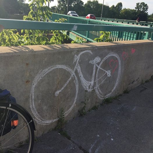
Look at that poor bastard on the bike. If you zoom in, I bet you can see the hunted, wary look in his eyes.
Among the features of Bank Street which should die in an ALL-CONSUMING, PURIFYING FLAME are such elements as: 
1) narrow sidewalks immediately abutting the roadway or separated only by barren asphalt kill strips; 
2) broken pavement, potholes, and sunken drainage gratings; 
3) lane widths that allow - nay, encourage - drivers to average about 75 km/h; 
4) heavy truck traffic; 
5) wide parking lot entrances crossing the sidewalk; 
6) major intersections with those damn "eyebrows" allowing faster and more careless right turns and requiring pedestrians and cyclists going straight to cross three stretches of hostile pavement instead of just one;
7) drivers who are so pressured by the fast, heavy traffic to get through their turns into parking lots quickly that they cut off and endanger pedestrians; 
8) a complete lack of reasonable lighting; 
9) hydro poles and other utilities blocking entire sections of sidewalk; and 
10) a sidewalk across the bridge to South Keys that is so narrow two people can't actually pass each other going opposite directions.

It's also just plain fugly, but I guess you could argue that ugly never killed anyone. But then, maybe it does. Maybe it's part of the reason the whole street feels so antagonistic, for everyone. It's not pleasant to drive on, it's downright unpleasant to walk on, and it's scary enough to bike on that most of my friends who live in my neighbourhood, and who have expressed an interest in riding, don't ride - like, at all - because there's no sensible way to avoid Bank Street. 

So. There is a consultation tomorrow, at Jim Durrell Recreation Centre, from 6:00 to 8:30. I'm so there. And in advance, I'm reading through the presentation given back in June about this.

This street has been in discussion for about ten years, and there have been a few studies so far to look at what is falling apart (the pavement, underground utilities) and what the future needs of the area are going to be. Really, the main issue with Bank Street is that it is a) an arterial route for cars, b) a key transit route, and c) a spine route on the cycling network. And all of that is because it's the only road that crosses all three of the main barriers in this part of the city - the CPR rail line, the Rideau River, and the Rideau Canal. There is really no other practical way for people from South Keys to get to Old Ottawa South, the Glebe, or downtown. Or vice versa. By any means.

So, it needs to be able to accommodate more than just cars. It needs to be - dun dun DUN!!! - a Complete Street.

Which is something the City (theoretically) decided on back in 2013. A complete street has to balance the needs of different modes of travel and hopefully come up with something that is safest for all. When they developed the complete streets model, they also adopted Multimodal Level of Service (MMLOS) guidelines.

These guidelines are a newish thing in Ottawa, and encouraging to see. They basically force you to assess trade-offs in comfort and safety across modes. The grades in the chart below go from A (convenient, comfortable, safe) to F (long delays, high stress, unsafe).


And they've done an analysis of Bank Street as it stands now, and the targets they want to hit. It's extremely telling.


This is the analysis of five intersections with Bank: Riverside westbound and eastbound, Heron Road, Alta Vista Drive, and Walkley Road. If you can't read it, the dark burgundy represents an "F." Dark green is an "A." The shades in between go from E/F (rose) through B (light green). 

Would you just look at that upper chart. Would you just look at the "bike" column. And the "pedestrian" column. The only A on the whole chart is for heavy trucks, at Walkley and Bank.

Walkley and Bank looks like this. 

My reaction: Oh god oh god kill it with fire. Maybe that's just me.
I have, in fact, made left turns at this intersection on a bike, in the traffic lanes. But I have since found ways to avoid going anywhere near it so I don't ever, ever have to. So I encounter this intersection on foot, mostly. And it's nasty. Not only are the signal intervals uncomfortably long while you huddle on the islands after having scuttled across those right turn lanes, but sometimes the crosswalk lights don't actually work on one side of Walkley and you wait through a cycle or two before figuring it out. People frequently do that thing where you cross half of the intersection while the advance-left is on, so there's time to finish crossing when you actually get the light.

Anyway. Back to MMLOS. This is the same two charts - existing conditions and targets - for segments of the road rather than intersections.


That lone, floating "B" grade for bikes, in the top chart, represents the section of the street that runs past Billings Bridge Mall, where there is a bike lane, coated in bright green thermoplast wherever it crosses a merge lane or intersection. And yes, that bike lane is a huge improvement on the street. I'm lots more comfortable on it, even if traffic zips past me at high speed. It vanishes, however, south of about Ohio. And you will note that the whole stretch is universally bad for pedestrians. The only A grades? For trucks, at the north end of the street, starting at Riverside westbound (at which intersection Meg Dussault, of #megsbike, was killed three and a half years ago. By a truck.)

The targets are much more hopeful, looking toward better pedestrian and bike experiences, particularly around Billings Bridge Mall (currently a hotspot on the map of reported collisions involving cyclists and pedestrians) and from Walkley to Kitchener. I can see why those areas are priorities. Across from Billings Bridge there is a cluster of high rise apartment buildings. People are constantly ducking across the street to get to the mall and to the Transitway station. Between Walkley and Kitchener there is the local MP's office, a Shoppers Drug Mart, the Beer Store and LCBO, an optician, a consignment store, a couple of auto body shops, a mini mall with all sorts of services, a few restaurants, the Home Depot. When I walk in my neighbourhood it's usually in that area, to get to the shops. And it's the worst area to walk. 

So how do we fix this car-centric pavement-veldt where the strongest, fastest and heaviest prevail?

The initial design plans I've seen involve narrowing the car lanes a bit, carving out a bike lane on either side of the street, and adding a bit of boulevard space between the curb and sidewalk. Not a huge change, really, but if the lanes in front of Billings Bridge are any indication, they do make a difference. Paint may not really protect you from anything, but it does help to nudge the position of drivers on the road so you get a bit more space. And the green paint makes the intersections along that stretch feel just a little less hazardous.

It's always seemed clear to me that you could hack out a bike lane from the existing roadway on Bank Street and never have to move a curb. The current roadway is, in one studied stretch, 20.8m wide, for four lanes of car traffic (broken down, that's more than 5 metres of space per car. Allow my eyes to roll at the type of giant baby that can't handle a car in less than 15 feet of space).

The outside lanes are 4.5m wide, the inner lanes 3.25, with a median between them that's 4.5 m wide as well. If you just took the outside car lanes down to 3.25, which is clearly a completely reasonable width, because one lane is already that wide (and well within lane width targets if I read the charts right), you'd gain 1.25 m for a bike lane. And that's without touching the vast median.

Big wide medians that keep cars going in opposite directions from getting anywhere near each other do one thing: they allow drivers to feel nice and safe going at speeds well above the speed limit. Like 30 to 40 km/h faster. Which they do. It's really not uncommon or shocking to find someone going 80 or 90 along Bank between Billings and Walkley, where the limit is 50. Narrow or get ride of the median, the drivers slow down, and you've gained even more real estate for your bike lanes.

Maybe even enough to make them separated and protected. A raised, quieter, safer buffer between the pedestrians on the sidewalk and the motor traffic.

Kind of like these options:


A raised cycle track on Bank. I could only dream. Oh, wait. I spotted, and made some noise about converting, those paved kill strips a year or so ago, didn't I? If we're already digging up the street we could move the hydro poles and voila, a cycle track. (I think any recommendations about burying the lines have been shelved, alas, but we'll see at the consultation).

I expect that the bike lanes won't come up against the usual business-owner objections about parking, because there is no parking on Bank. . . but I can already hear the furor over having them cross the entrances to parking lots. Especially ones like the Beer Store, where most of the length of the store's property is made up of access to the road, and the LCBO just down the street, which has three different accesses to its parking lot and already has its fair share of accidents because people don't know which to treat as an entrance and which as an exit.

Still, the objections, I imagine, will be about safety and logistics, and not about bike lanes driving away parking customers. At least, I can hope not.

Sharper right turns (i.e., not rounding off the intersections and allowing right-turning cars to have their own mini merge lane) will probably piss off some drivers too, particularly truck drivers (and I'm not sure how you accommodate transport trucks in this design. Which you probably have to, since Walkley and Bank both have highway ramps on them and there are so many large stores along the street...)

But regular car drivers would just have to suck it up and make more careful turns, and that will anger some of them. I've heard that complaint about the O'Connor lane already from some drivers. "The turns are so sharp and they've got these big curbs so if you don't stop and go through the turn really slowly, you could scrape your car!" one co-worker said to me.

(. . . That's kind of the point.)

Anyway, so far all I've got to go on is this summer's presentation. I'll know more tomorrow night. I'm trying to get straight in my head what I think would work and what's actually likely to happen (this city can talk a good game in the planning stages and then somehow totally lose the plot until you have Booth Street on your hands, after all). It's a great big complicated bunch of tradeoffs, but it's always been clear to me that there has always been the space for a complete street on Bank. The real estate is there. It's just the will to reallocate it. And the improvement could be so huge. I'll keep my hopes up: I might as well.

Friday, October 21, 2016

In the early morning rain


It was still raining when my alarm went off at a quarter to six this morning. But then, I'd expected as much. It's apparently going to rain for about four days. It's October. These things happen.

It's also really dark that early in the morning. But at about 6:15, when I left the house, traffic was blessedly quiet, which was good, because I was out in the middle of the lane on Heron to avoid the puddles (you never know what's under the water, and the potholes on Heron are epic).

I took Bank past Lansdowne and only jumped onto the convenient shared sidewalk once, to skip past a bus picking up passengers. Then it was off to the corner of Catherine and O'Connor to meet up with Hallie Cotnam, from CBC Ottawa Morning, and JP (better known to Twitter as @MrOneWheelDrive).

I got there early, so I got to go a little further up along the lane, and then go hide out underneath the Museum of Nature's iceberg sculpture. I hadn't really been up close to it before: it's a beautiful piece. And it provided a little shelter from the chilly rain. I also pedaled around the new Museum gardens and read a couple of the information panels by the light of my headlamp.

One of the cool things about going places by bike: you can stop and poke around. Even if it's 6:45 in the morning, still dark, and raining.

After a bit, I headed back to the corner, propped my bike up against a wall, and then spotted JP rolling along O'Connor in my direction. We said hi, waited a little bit, and then Hallie appeared, toting the CBC field kit - a briefcase packed with all kinds of telecommunications stuff - and a transparent plastic umbrella.

We talked a bit about the lane while we waited for the green light from the station, and Hallie got a photo of the two of us to post on Twitter.


One kind of funny thing was that we all more or less knew each other from Twitter (well, and we knew Hallie from listening to her on the radio) but I'm not sure I had ever really been introduced to JP. Still, we all knew each other from #ottbike, so it wasn't like we were strangers.


We got a couple of other photos and tweeted them out before the interview actually kicked off. Then Hallie got the headphones out, and we all huddled under the plastic umbrella (which I was sort of holding over the field kit, although it wasn't raining hard at that point) and had a chat about the lane.

It's hard to know for sure yet where the problem points will be, and I'm sure there may be some. But for now, O'Connor actually feels safer than Laurier - mostly because there are fewer driveways and turnings but also, since O'Connor is one-way for cars, the cars aren't crossing the bike lane from all possible directions. It's less busy as well, with fewer pedestrians ducking across and fewer cars turning at the entrances to loading docks and parking garages.

And the advance lights for bikes actually made me giggle as I crossed Isabella and went from two-way South O'Connor to one-way North O'Connor, across the highway ramp. I honestly felt as though I was getting away with something.

After the interview, we talked a little longer and then I headed off northward in search of breakfast and coffee. On the way, I passed someone in a yellow vest who waved at me as I passed. I grinned and waved back, then stopped, turned, and circled back to ask what was up (seriously you guys not enough has been said about the fact that you can just change directions on the O'Connor lane and you don't have to use a crosswalk or wait for a light or anything you can just double back).

It was Kathleen Wilker, who I know through Citizens for Safe Cycling, but who was there with EnviroCentre. They had people stationed at the intersection to wave and welcome cyclists to the new lane, and also to explain the bike boxes, installed so you can make left turns, in case anyone didn't know how to use them. I think she said they'd be out handing out coffee the next morning, as well. Even in the chilly rain, she was still pretty cheerful.

Then I rode on to the intersection with Laurier, turned left and dropped my bike off at the Centretown BUZZ office, and went over to Minto Place in search of a hot breakfast and a very large coffee.

Thursday, October 20, 2016

O'Connor (legitimately this time)

The O'Connor lanes are open! Excitement is in the air! It's palpable!

Might be more palpable, to be honest, if on the day the lane officially opened it hadn't been slowly, dismally raining for hours.

And 3:30 pm might have been an odd time to open it. I saw a couple of friends posting on social media that they were looking forward to riding on it, then being confused that it was still barricaded.

But that aside, it's worth celebrating - making a big deal out of, even - the opening of a major new piece of infrastructure. We've been waiting for this one. It's even open ahead of schedule. Pop the champagne!

Someone at work complained this afternoon about the concrete barriers, which make it harder to cut the corners on right turns. "You have to make such a sharp turn," he said, "or you'll scratch up your car on those things. And it'll just be worse in winter." He complained that traffic was already slow on O'Connor and now people making left turns were having to stop and hold it up further. Someone else mentioned that the adjustment period while drivers got used to looking for bikes coming northward on a predominantly southbound street would be dangerous.
But then I bumped into a friend this evening who told me that she had just driven through the mess of on- and off-ramps where O'Connor crosses Catherine and Isabella and runs under the highway, and she told me it was far less scary and confusing now. "You know which lane to be in if you want to get on Colonel By, and which one goes to the highway," she said. "The signage is a lot better. It's a lot clearer."

Anyway, this morning, my cell phone rang at work. It was someone from CBC Radio's Ottawa Morning wondering if I would be willing to come downtown tomorrow morning to talk to Hallie Cotnam about the lane. I said sure, and then they told me the interview would be at 7:00 am.

(But I would have said sure anyway.)

They also asked if I could give the lane a test ride today so I could check it out. I had an evening meeting, so I started home on the lane at about 8:30 pm. It was pouring. The kind of rain that comes in around your glasses straight into your eyes and makes you blink constantly, and gets all over the lenses, which are already steaming up from your body heat and breath in the cold night air. And makes all the signal lights reflect off the pavement so it's hard to tell what you're looking at, and obscures road markings, and makes unlit cyclists and pedestrians damn near invisible.

So, when I set out on the O'Connor lane, I was doing it under the worst possible biking conditions. Go me.

First impressions, rain-glazed and unclear though they are: the intersections felt okay. Where cross streets enter O'Connor, the bike lane is marked out in green thermoplast. Stop lines are further back, "yield-to-bikes" signs are more sensibly placed. I had my head up and my antennae cranked at each cross street anyway, because I didn't know how they would work. But between the fact that it was late, so there were very few cars on the cross streets, and the fact that it was pouring rain, so there were no other cyclists (none), the ride was confusion-free.

The only thing that made me jump was the sheer speed of cars coming up beside me. Even though I knew they were separated from me by a concrete barrier, cars fly along that street and are noisier in the rain, and I flinched a couple of times as cars blasted by on my right.

At the Catherine/Hwy 417/Isabella crossing, I didn't know what to expect. When I rode this lane illegitimately, jumping the gun, this intersection was unfinished and baffling. Terrifying, even. But now it was kind of glorious. You just stay on the east side of the street.

How bafflingly simple is that?

The bike lanes continue straight, on the east side, across Catherine, under the highway, and across Isabella, with two different, very clearly defined, separate bike signals to allow cyclists to cross before left-turning, highway-bound traffic proceeds. The bicycle lights are even bike-shaped to make it more obvious, and the green thermoplast leaves no doubt about it. There's a bike signal before you cross Catherine, and another at Isabella.

(I haven't seen how the traditionally hellish pedestrian crossing has changed, if at all, on the west side of the street. I guess I will tomorrow.)

Once across Isabella, the bike lane continues for about a block, then the southbound half of it crosses to the west side of the street. It was very dark and rainy, so I couldn't see exactly how but, on a street as quiet as O'Connor suddenly becomes at this point, it's not such a crucial thing. Then there's a painted bike lane which runs up and over pedestrian bulb-outs at the corners, the rest of the way to Lansdowne Park. It was flooded tonight because of the rain, and my shoes got drenched: the pavement could be better, but at least there's not a lot of traffic.

At Lansdowne you have to turn up along a contraflow bike lane on Holmwood, which is scary in the dark and the rain: narrow, with cars coming toward you past a line of parked cars, and a narrowish bike lane. I was unnerved by it. And the less said about my experience of Bank Street past Lansdowne, over the bridge, through Old Ottawa South, and on to Billings Bridge, the better.

So I may not be taking the O'Connor lane every day. Mostly because it's lovely until you get to Holmwood, and then you're dumped onto Bank Street at Lansdowne. Which is not great at the best of times, and terrifying in the rain. If I take the canal to get to South Ottawa, I get to skip all of that horrible crap and get onto Bank down by the Rideau River, avoiding the whole stretch between Holmwood and Riverside. So I'll probably keep taking the canal for my commute.

But that's not to say that O'Connor won't be my very first choice if I'm going to the Mayfair Theatre after work, or to Lansdowne Park, or if I want to get to the Glebe Community Centre or McNabb Park. Or if I need to stop at Kettleman's Bagels on the way home. (This is a need that could happen.) And if I need to get north/south in the downtown core, this and Lyon will be my go-tos.

Thursday, October 6, 2016

What's the opposite of microaggression?

Crossing Billings Bridge this morning, I was in the middle of the outside lane. It's a four-lane bridge, with sharrows painted on the outer lanes, but it's wide enough that if you ride along the sharrows some drivers will still think they can squeeze by you, so I always claim the full lane. 

I had cars behind me, but I figured the drivers wouldn't mind, since I was still going faster than all the cars lined up bumper to bumper in the inside lane. (Just after the bridge the outside lane goes over to parking.) I was just thinking how it was kind of ironic that I was going faster than all the cars and had the lane to myself when -- 

-- Someone in a white Golf suddenly pulled out of the lineup and nearly right into me, cutting me off. 

"Whoa! WHOA!" I shouted at the top of my lungs (the only way to make a noise loud enough that you have a hope of a driver hearing you), first as I saw the car begin to turn and then as I realized it wasn't going to stop and I swerved and braked a bit. The car continued on, and I did the large, arm-sweeping "what the hell, man?" gesture, but kept pedalling along behind him.

He turned right onto Riverdale just past the bridge, and as that was where I was going to turn anyway, so did I, thinking, now that guy probably thinks I'm trying to chase him down. 

And then he slowed down, and pulled over to the side of the road. 

A few things went through my mind. First, here he was doing something else I couldn't interpret. Was he parking? Pulling over temporarily? What was he going to do next, and could I get clear of him before he did whatever it was? Second, I saw his window rolled down and thought: ah shit, he's going to try to bawl me out because he thinks I wasn't supposed to be in the middle of the lane or something, and this is going to be one of those stupid yelling matches. Third, I thought: well, okay, but I need to say something, right? 

Anyway, the window was down, so I stopped beside him. Not caring if I was jamming up the cars behind me or anything. They could wait or go around: presumably they'd seen what had just happened between the two of us back on the bridge. And the driver looked up at me through the open window and said, "I'm so sorry."

Which was unexpected, I'll admit. I'd been bracing for all the usual recriminations.

"I'm really sorry," he said again, "It scared me too. I honestly didn't see you till I heard you yell, and then there was nothing I could do about it. The sun just blinded me and I shouldn't have pulled out like that."

I assured him that I was okay - I was, after all. I'd seen him start to turn so I'd had time to react: he hadn't even really scared me as much as he'd clearly scared himself. It was all a lot more sudden for him, after all. And, being aware that we were stopped in the middle of the street, I said thanks and yes, I was fine, and to have a good day. And really, I wanted to say more. I wanted to tell him that I hoped the rest of his day was utterly confrontation-free, and that I wished him nothing but good people and kind interactions, in return for his having stopped to talk to me. But all I really said was something like, "Have a great day, man," as I got rolling again.

So, to that guy: thanks. Genuinely, thank you. For the kindness of stopping to speak to me, and for reminding me that it's very possible, in those cases where I shout, gesture, and mutter, "asshole," at someone for cutting me off or whatever, that maybe that person actually drives away feeling remorse for their moment of thoughtlessness, and just doesn't have the presence of mind - or the opportunity - to pull over and try to apologize. 

Thursday, September 22, 2016

Four-way flasher

At about 10:30 tonight, I was soaked through and shivering, and starting on my way home along Laurier. It hadn't been the most brilliant evening: I'd been caught in the pouring rain, with a barrage of back-to-back commitments to get to, and I had a thrown-out, painful back and very wet feet, so I was not in a mood to take any bullshit when I saw, up ahead through the dark and drizzle, the SUV parked in the bike lane with its running lights on.

I pulled right up behind it. The guy in the car was just sitting there. I planted my feet.

"Excuse me!" I shouted, as loud as I could.

And you guys.

No listen, really.

But listen.

He put on his four-ways.

For real. Like "hey, it's cool, I got flashing lights that say I can be here."

I almost laughed. "Four-ways don't cut it!" I shouted.

And his four-ways went off. He revved his engine once, almost half-heartedly, like he thought "yeah, man, this'll freak her out," but without a whole lot of conviction.

I folded my arms.

He tapped his reverse lights, again without any real intent behind it.

I cocked an eyebrow.

And then he yanked the wheel sideways, lurched forward and out into the traffic lane, and sat there dumbly, while I rode past him and on over Elgin to the canal path.

Wednesday, September 21, 2016

O'Connor preview!

It is perhaps only fitting that the first I heard that the O'Connor Bikeway was nearly finished was this tweet, showing that even before its official opening, oblivious drivers were . . . well. . . it was inevitable.

And may the odds be ever in your favour.

But never mind that: the O'Connor Bikeway is nearly complete! Complete enough, anyway, that I checked it out for my commute home from work this evening.

Quick refresher: this is the bidirectional bike lane that will connect the downtown core to Lansdowne Park, via the Glebe. It will give cyclists an option other than the chaotic and cramped Bank Street to travel north/south. And yes, it has already caused, and will probably continue to cause, much pearl-clutching, NIMBYism, #neversatisfied and automotive indignation from various corners. That's okay. That's how we move forward.

I caught the Laurier lane (newly furnished with staggered stop lines for bikes and cars, thank you City of Ottawa) west to O'Connor. When I realized the bikeway really was open, I hung a right onto it. Turning right onto the lane is a little odd, since you have to bike across O'Connor, then cut through crossing pedestrians on the green. But I managed it okay and got myself behind the poured-concrete barriers (not laid-down bars of concrete like the ones on Laurier).

And then I was on this bikey highway!

For most of the downtown core, the lane is separated from motor traffic by poured concrete dividers. Green paint alerts drivers to the danger points at the intersections, and there are bike boxes to allow turns to the west. At the intersections the concrete barriers are cut down to near road level, presumably so left-turning vehicles don't wreck their tires.

At the first red light, a man rode up, stopped just behind me, and said, "Is this really for bikes?"

"Yup," I told him. "It's two directions all the way along O'Connor. Going to go all the way to Lansdowne."

"Really?" he said. "Wow! That's amazing!"

"Yeah, it's pretty good, huh?" I said as the light turned green and we started pedaling again.

It's definitely still a work in progress (if the traffic cones didn't give it away). At one point I had to avoid a tipped-over construction sign that had fallen into the southbound lane, and at another I rode through a set of cones blocking off the lane. But I wanted to see what the whole thing was like, so I weaved between the cones and kept going.

I went on alert when I crossed side streets, assuming that people wouldn't be used to the lane being there, and not seeing a whole lot of signage about how the intersections should work. But for the most part, they're quiet streets on that side of Bank.

I don't know how the intersection at the Queensway is going to work. I have heard the solution is good. It's not installed yet, though, so when I got to the block before the highway underpass, I had a moment of doubt.

That intersection has always been terrible. Four lanes of motor traffic, one-way, come to a set of highway on-ramps, and turn right to go west, or left to go east, while one lane continues south onto a small, residential, two-lane street. A cyclist is forced to merge left into the second-from-right lane to go through, or to duck to the sidewalk and use the pedestrian crossing. Meanwhile, the pedestrian crossing is a desperate, two-stage game of Frogger across an east/west street (Catherine), then the highway on-ramp (these two crossings are separately signalled), and then under the highway and across another street (Isabella).

Now, as it happens, the unfinished bikeway ends, and you have to merge to the right across two lanes: I waited for traffic to get a red light before I even attempted it.


And then you get into the second-from-right lane as you would normally. Not shown: the transport truck in the right lane that I was waiting beside.


I ducked to the other side of the traffic cones at the orange sign with the arrow, assuming that is where the bike lane will eventually be. None of it is marked or built yet, though. But on the other side of those traffic cones, there's a space and a separate traffic signal for bikes on the far side of the underpass. 

On the other side of the highway, O'Connor becomes a sleepy, two-way, residential street, and the segregated lane turns into a painted bike lane, or maybe just an advisory, I'm not sure. But the pedestrian bulb-outs that used to cause cyclists to merge in and out of the motor traffic lane have been smoothed out and the bike path continues across them now: this is an improvement, in my opinion. 


Also, at all the four-way stops, the bike stop line (laughable though that idea is, because almost no one comes to a full stop at these intersections, car or bike) is set ahead of the car stop line. A nice touch, if kind of pointless: it shows a general standard that's being adhered to for this kind of infrastructure. 


As you get closer and closer to Lansdowne Park, the lane gets less distinct. However, where O'Connor jogs at Fifth, there is an existing contraflow bike lane that takes you up the rest of O'Connor, counter to the car traffic, and gives you a lane to travel west toward Bank Street (the motor traffic is one-way east here). 


At Bank Street there are bike sensors, and a bike signal to let you turn. After that you're on your own with the "super sharrows" over the infamously terrible Lansdowne Bridge, the traffic pinch in front of the Mayfair Theatre, and claiming your lane all the way down Bank Street to where the bike lane starts at Billings Bridge Mall, just past Meg's ghost bike. And south of Ohio Street, godspeed. 

Still. Unfinished as it is, it looks good. There were already a considerable number of people riding on the lane downtown, and that one guy was pretty excited - and surprised - to know it was there. The education period is going to be interesting, seeing as we already have people parking on the lane, and I'll watch what happens with the intersections. Left hooks are still a bit of a threat too.

But it's a step. 

Interestingly, Strava tells me it doesn't cut any noticeable distance off my commute (usually I take the canal MUP) and it's actually a little slower because of all the stop lights. I also have to ride on Bank through Old Ottawa South if I take this route, whereas when I take the canal I can skip that stretch of Bank Street and come out at Riverdale, near the bridge over the Rideau River. So I don't imagine I'll be commuting along O'Connor much, except maybe in the winter if it's better cleared than the canal path. 

I can see a lot of people finding it really useful to get to the Glebe though. If I don't need to go further south than Lansdowne I'll use it, for sure. 


Monday, September 12, 2016

The classic Laurier Avenue moment

This morning I was on the Laurier lane, riding along at a reasonable speed (I don't go particularly fast on Laurier for all the obvious reasons) and approaching a green light at Metcalfe.

Just as I reached the intersection, a blond woman, probably in her forties, in an SUV, turned directly across the lane. No turning signal, no warning. I hit the brakes and screamed, "STOP! STOP!!" at her. I heard a couple of the pedestrians on the corner scream too - distinctly. I don't think I've ever heard another person scream like that before except in movies. There were screams all around me and the side of a bluish-grey vehicle right in front of me.

I came to a stop inches from her car: she continued around the corner without even looking in my direction. I couldn't even be sure she'd heard me scream. She must have; but I saw no sign of it.

I remember looking through the whole car at her and, oddly, thinking how far away from me she looked, separated from me by the side of the car, the passenger seat, the huge wide cabin space. She looked like she was twenty feet away from me and very small behind the wheel. Insulated from everything.

Her car passed, and I kept biking because I needed to get to work, I didn't have a license plate, she hadn't actually hit me, and there was no point in reporting it.

I wasn't the only one to go through this on Laurier today.

I guarantee I wasn't.

We have got to do better than this.

Tuesday, September 6, 2016

Conversations on the bike lane

I was on my way home a little late tonight - around 7:15 or so - and heading along the Laurier lane. I stopped at a red light on Metcalfe and a woman crossing the street called out, "Please be careful when you're turning!"

I wasn't turning. I wasn't doing anything. I was just sitting at a red light with my foot on the curb. And for a fraction of a second, I went into "defense against the concern trolls" mode. But then I realized. This was her reaction to the death of Nusrat Jahan.

In case you aren't in Ottawa and don't know, Nusrat Jahan was on her way to school last week on the Laurier segregated bike lane - Ottawa's flagship piece of bike infrastructure - when she was right-hooked by the driver of a dump truck and crushed under its back wheels. She died at the scene. She was 23 years old, the daughter of a Bangladeshi diplomat, and a student at Willis College with plans to go on to study business at Carleton University. She was only a couple of blocks from home. Her death appalled the whole city.

The woman who'd called to me to be careful was hurrying across the street. I said, "I always am," and gave her a smile. I figured that would be it. But she came over.

"I don't mean to hold you up, I'm sorry," she said, "but really, if there was a truck next to you, and it was turning, wouldn't you stop?"

"Yeah, I would," I said. "I'm always very aware that I need to watch what other vehicles are doing."

"But why would you - even if you have a green light, you wouldn't just assume you can go right through because you have right of way, would you?"

"No, I wouldn't," I said again. "I know I have right of way. But I also know the cars are bigger and heavier than me."

"Well, you do," she said. "And I know that poor girl didn't deserve to die. But with a truck right there, wouldn't you stop?"

I knew she was trying to figure out how this could happen. Why making a simple mistake would have to end one life and horribly impact another. How a lapse of attention on the way to school, or the way to work, could turn deadly. We all want to figure that out. We all want to stop it from happening. Somehow. How?

She'd heard the coverage, she'd heard cyclists saying that drivers don't care. She was a driver, she told me: and she cared. She wasn't just going around blindly mowing down cyclists, but there were so many chances to make deadly mistakes. Didn't the cyclists have some responsibility?

I assured her that most cyclists don't think drivers don't care, that the anger she'd seen wasn't about drivers, it was about the failed infrastructure. I talked to her about how the intersections on Laurier fail: the signs telling motor vehicles to yield to bikes are too far away, too hard to see. The blind spots on large trucks are dangerously big, and the trucks don't have side guards. The intersections put right-turning cars and cyclists in dangerous proximity all the time. "What do we do to fix it?" she asked me, as another light cycle passed and she apologized - "I don't want to hold you up, but - "

"There are things we could do," I said, and we talked a bit about protected intersections, advance signals for bikes.

"What about putting the bike lane in the middle?" she said. "Then you'd have to stop." I tried to explain that getting in and out from a bike lane in the middle would be every bit as dangerous and complicated - probably more. To be honest, I couldn't really picture how you would do it, and couldn't come up with a single example of where something like that had been tried. But she seemed to think it was the best solution.

Eventually, agreeing that there had to be something we could do to make things safer, the two of us said goodbye and she went on her way, telling me to be safe.

Riding home, I thought about what that conversation was really about. I'd just spent a few minutes talking about the fine points of street design with someone who probably doesn't normally think about it. Someone who was beginning to see where the deadly gaps are in our infrastructure, the places where it fails. And someone who was genuinely, deeply concerned about it now, because Nusrat Jahan was so young and her death was so senseless, and suddenly she could see very cyclist and pedestrian, and the danger they were in. And she was impelled to talk to one of us about it and try to understand.

And if there is anything good at all that can come out of something as terrible as Nusrat's death, that might be it. We are talking about our streets right now. The whole city is talking about them, to complete strangers, while the traffic light cycles through another sequence.

Tuesday, August 23, 2016

Making your own path

A while back, I participated in a transportation audit of my neighbourhood, along with some people from ACORN and the Healthy Transportation Coalition. We walked around the streets and noted things that needed fixing to make it easier to get around by bike, on foot, or with public transit. Things like cracked pavement, unsafe intersections, areas with bad lighting, places where there should be bike paths.

This spring, I got together with a bunch of people over at the mosque around the corner from my place to form a working group, organized by the Healthy Transportation Coalition. We talked things over and eventually ended up voting to tackle a couple of key spots.

The stone dust path through the park. Not pretty. 
One of those spots: Sandalwood Park. It's right behind my apartment building in the densely packed Herongate complex. Somewhere around 5,000 people live in Herongate, and they all cut through Sandalwood Park to get to the grocery store, drug store, and mall that is rapidly being rebuilt on the other side. (Long story: the old Herongate Mall was torn down a couple of years ago because it was falling apart. Now there is a series of retail clusters going in, including a drug store, a couple of fast food outlets, a Petsmart, and the FoodBasics grocery store.)

The complex has a lot of extended families living in it: households with parents, young children and grandparents. Maybe partly because it's a low-income neighbourhood, there are also a lot of people with baby strollers, canes, walkers, and wheelchairs.

It is universally agreed that this path is a nightmare in the winter. It's paved with stone dust, and it turns into a pitted, slurry-coated mess when it rains. In the winter, it's not cleared, so people have to pick their way through the snow, eventually creating an uneven, tamped-down ice road that glasses over every time the temperature drops, making it treacherous even for me, a generally able-bodied and physically fit person.

Add to that, it's not lit at night. Neither is the basketball court, or the soccer pitch, even though evenings are the most vibrant times in this neighbourhood. Everyone, it seems, comes outside on cool summer evenings. The kids play soccer and basketball and play on the play structure, and the parents bring out thermoses of tea and sit on the grass to talk.

So, we figured we could organize a sort of pop-up action to point these problems out, and show the city (and the neighbourhood) what was possible.

Checking out the cycle track that never
happened with Councillor Cloutier. 
Over a couple of months, we talked to the local city councillor, Jean Cloutier, and tried to get some sense of what we might be allowed to do. I went with Trevor Hathaway from the HTC to meet Cloutier in his office, and he seemed keen. (He seemed less keen as time went on.)

We had also had some notion of trying to turn the paved kill strips on either side of Heron Road into temporary cycle tracks, but that proved to be a step too far for the City engineers, who couldn't sign off on it for "safety reasons."

Anyway, we at least got the go ahead to do a temporary "paving" of the pathway, and to string up lights in the park, on August 20, the same day as a "FunFest" being put on by Timbercreek, the property management company that runs Herongate.

So, last Saturday, I met up with Trevor at the park to - ahem - forge our own path.

He'd been to Canadian Tire (the Bank and Heron location), who gave us a discount on all the materials (shout out), and had a van full of 50 industrial rubber mats, 30 solar lawn lights, a ton of bike lights and clip-on lights, three strings of LED Christmas lights, and a solar-powered security light.

Job one: get the mats laid out and create a "paved" path. We dropped them off ten at a time along the path, then laid them all out end to end, overlapping slightly, and started working on taping them to each other. (The tape was a City requirement. We couldn't create a "tripping hazard.")


Once we had them all laid out, we could start trying to tape them down. The tape was actually a bit of a battle: turns out even duct tape doesn't really want to adhere to industrial foam mats. But we were undeterred! 


Eventually we resorted to stamping down all the tape with our feet to try and get it to stick. Mostly, it did. Mostly. 


Anyway, when we finally had all the mats down, and had gone through more than 120 yards of duct tape, we had something that looked amazingly - almost surreally - like a paved path. It was kind of beautiful. 


With the path set up, we set to work talking to people about it. There were crowds starting to gather for the festival, so I went out walking through the crowd talking to people and seeing if they wanted to fill in a short survey, basically just expressing support for the path being paved. 


I was amazed at the response. I once worked for a telemarketing company. I remember how hard it was to get people to answer a survey. This? Not hard. I would say, "Have you got a couple of minutes to answer a couple of questions about this pathway? We're trying to get it paved and cleared in the winter and lit at night," and people jumped at the chance. I had all of one refusal, and that was because he said he never used the park. Everyone else said, more or less, "hand me the clipboard, where do I sign?" From a bunch of lanky teenage boys who said, "You want to light the basketball court? Aw yeah!" to the graphic designer walking with a cane who said, "Oh, thank you for doing this, you're my new best friend, where do I sign up to know more about this?"


I think the telling bit was when Councillor Cloutier showed up. Someone came to get me to be in a group photo on the "pavement" with him. There was a photographer from the Ottawa South News there. As we were figuring out where to stand, she jokingly said to Cloutier, "But you know, if you're in this photo, you have to pave the path." 

He walked away. Just turned and walked away. The reporter even chased after him: he'd spotted the Gloucester-Southgate Green Party candidate and was walking with him toward the barbecue. She asked if he wanted to come back for the photo. "Not that photo," he said. And kept walking. 

(The Ottawa South News article about the event gives you a pretty discouraging sense of his attitude toward the project.)

But we walked around getting signatures. By the end of the festival, we had 110 completed surveys and had run out of copies in English. 

As the festival started to wrap up and the wind picked up, bits of the "path" started lifting in the wind and blowing away. 

Sic transit gloria mundi.
Finally we stopped trying to just clean up the bits that were actively flying off, and picked up all the mats, loading them back into the van. But it was time now to start setting up the lights! 

We had a 100-foot measuring tape, and the HTC's summer student, Mariema, helped me spool it out to mark off 20-foot intervals and make preliminary holes for all the ground lights. The thing we hadn't counted on was the large numbers of children in the park who would think the idea of a 100-foot measuring tape was great fun. One little dude, about two years old, I think, got hold of the end of the tape as I was reeling it in, and wound up being pulled in like a fish. He was pretty darn cute, but I kind of figured we might be in for some trouble. 
Yeah. Eventually a whole crowd of kids had clued in to the existence of 100 feet of measuring tape, spooled out. It got to be kind of chaotic. 


Eventually, though, we got the path measured out and the holes started, all ready for the solar lights. 

The last thing I did before I had to head out for the evening was to clamber up our 20-foot ladder to attach a solar powered security light to a light standard, using the high-tech method known as "zip ties."  We couldn't also put up the solar panel that charged it, but then it was only going to stay up until 10:00 pm, after which the City - who apparently have a problem with lights in parks - said we had to take it all back down. 
And then I headed out. Trevor and another volunteer stayed on to set up the path lights. 


I came away from the day with a sunburn, a sense of discouragement about City Hall's support for this, and a sense of encouragement about my neighbours and their support. I got to meet a lot more of my neighbours than I had before, the "paved" path looked awesome, and the lights were beautiful. And I got to help improvise a bunch of solutions on the fly as the day went on, which is always satisfying. 

Will our councillor do anything about this path? It doesn't seem likely. But on the survey we handed out, the last question asked what actions you were likely to take in the next year to fix an infrastructure problem in your neighbourhood. One of the teenaged bike-riding boys I got a survey from had answered, "I'd do something about it on my own with my friends."

Sunday, July 31, 2016

You know this means war. #MegsBike

The story of Meg's bike just keeps snowballing.

By now you probably know the back story, and if you don't, most of it is in the link above. Anyway, I have started keeping an eye on the corner of Riverside and Bank, and keeping a box of Crayola sidewalk chalk in my bike panniers. After it rained, I'd stop, usually on my way home from work, and chalk the bike back up. I got a bit creative at times, mixed it up a bit with bike styles, even with the direction the bike was facing (although I found I could only competently draw a bike facing left).

The idea was that I'd keep the chalk bike there, as much as I could, until something was done about the dangerous intersection. To date, three whole years after Meg was killed, nothing has been done to fix the infrastructure problems that led to her death.

But then the bike started disappearing with disturbing regularity. When it hadn't rained.

It poured last Wednesday night. I got caught in it, and drenched crossing the bridge. It was intense. But, I have chalk. So I put the bike back up Thursday night, on my way home from work.

On Friday morning, I rode past it on the way to work. But when I went by Friday evening, it was gone. It hadn't rained. Clearly, someone had come by and washed it off. But, I have chalk.

On Saturday - July 30 - around noon, I headed downtown to meet a friend, and was stopped in my tracks. The bike I had drawn about fourteen hours earlier had been washed away, at some point in the night. But what was in its place brought tears to my eyes.


That last one? It's a little washed out by the sunlight, but it says, "Bless whoever draws the bike." 

So yes. I cried on a street corner. Meg's family came to put the chalk bike back up, on the third anniversary of her death, and they thanked me. No: they blessed me.

So guess how I felt this morning when I saw this. 

Go ahead and guess.

Only the bike has been washed away. Not the hearts, not the other tributes written on the wall. Even the plea, "P. L.On," is still there. Meg's photo is still duct-taped to the wall. It's just the bike. This is the work of someone who, for whatever reason, specifically objects to memorials for people on bikes. Someone so threatened by a drawing of a bike done in white chalk that they find a watering can, fill it full of water, lug it all the way to the bridge, and sluice the chalk off in a fit of self-important rage.

Don't even get me started on the utter insult to Meg's family that this represents. On the eve of the anniversary of their loved one's death, this troglodyte marched down there and washed away the chalk bike. They went down there and drew it again, on the day she died, and actually asked him to leave it up. And the day after the anniversary of the death of their friend, daughter, wife, sister, aunt. . . he went back down there with his pathetic little watering can and his sense of entitlement.

This is someone who feels foot-stampingly righteous about removing even the chalk ghosts of the ghost bike that was once there; this is someone who thinks he "won" some kind of "battle" when the City came and cut the locks on the white bike that had been locked to that rail since August of 2013.

This is someone, in short, up with whom I will not put.


Chalk is cheap, bro. I can do this all day.

Wednesday, July 27, 2016

Can we talk (again) about Billings Bridge?

Billings Bridge is rotten, although it's far from the biggest trouble spot on my commute (that honour will forever belong to Heron Road). Really, as long as I can take the lane sometime before I cross Riverside on my way north, and have the guts to hold it until I can duck onto Riverdale, it's just about tolerable. But it's precisely that lane-taking that led me to a realization.

There are sharrows painted on both outer lanes on that bridge. I don't know, maybe they give drivers some notice that bikes are allowed to take up space. It could happen. (Though, today's news that OC Transpo is investigating a bus driver who crowded a cyclist, opened his door, and said, "You got your one metre, now get out of the middle of the road," is not really encouraging on that point.)


In my experience, though, as I defiantly take the lane across this bridge, I can't just ride along where the sharrows are. If you ride, as I suppose you're expected to, through the middle of the "sharrow space," there is still just enough room for a driver to try to squeeze past you without crossing the dotted line.

And they will try. It happens all the time.

So, I actually ride even further to the left of the sharrows, right down the middle of the lane, because it's the only way to stop some idiot driver trying to squeeze between me and a car in the inside lane.

And that's when I realized. If there is room for me to ride along the outside of the "sharrow space" and still have there be enough space that a driver thinks they can pull off a pass, then there is more than enough room to hack a foot - or maybe a little less - of width off each of those lanes, and carve out an actual, painted bike lane. It would slow traffic to a (legal) 50 kmh instead of the 70 most cars are doing. It would give cyclists a little more breathing room across an unavoidable bridge. It wouldn't require any major reconstruction of a "heritage" structure.

Do this, and you'd be making a bridge many cyclists outright avoid (meaning they don't cross the river to Billings Bridge Mall or points south, opting for their safety over, say, shopping) a bridge that would actually feel less suicidal to cross. It would extend the established bike lane on Bank in front of the mall to connect with a popular downtown-bound bike route (Riverdale, leading to Echo and the Canal). It only makes sense. Why hasn't anyone done this yet?

Oh, right. This city thinks sharrows are adequate infrastructure.

Monday, July 11, 2016

The Chalk Bike Anti-Massacree Movement

So, a while back, the City of Ottawa decided that there needed to be a time limit on so-called "spontaneous memorials" (in response to about seven complaints). By that they meant ghost bikes. And down the ghost bikes came, including Meg Dussault's much-loved bike at Bank and Riverside. 

In late June, I noticed that someone had drawn a bike back on the wall where Meg's bike had been: something I'd been wanting to do. 


But rain and the elements being what they are, it was gone again some time after that. Or, possibly, the city washed it away. We don't know. 

I said at the time that I wanted to get some chalk and go put it back up, but then got overwhelmed by Canada Day and a fairly busy couple of weeks. But never fear: Darlene McLeod (otherwise known as @UrbanSlowLife) was on the job. 


By the time I saw her tweet, the rain had washed it out again. But I said I'd grab some chalk and stop by on the way home. So I did. And we agreed, over Twitter, to keep an eye on the place and keep putting the bike back up as long as we can.

I pulled over on my way home, broke out the sidewalk chalk, knelt down by the concrete wall, and started drawing. Personally, I was pretty pleased with how it turned out. Apparently when I draw a bike, it's a stepthrough cruiser. 


The next morning, I told someone at work about it, and she said, "Oh, that was you? I saw that chalk bike this morning when I went by there!"

This weekend, it bucketed down rain. So, on Sunday, on my way home from a proofreading meeting, I stopped and put the washed-out bike back up. This time I gave it fenders, and added Meg's name in red behind the back wheel. 


I said, on Twitter, that I thought people should just adopt a site where a ghost bike once was, and do the same. Just chalk it back up every time it washed out, until something was done about the infrastructure that had resulted in there being a ghost bike there. Because there ain't no bylaw against drawing things with sidewalk chalk. Yet. 


I mean, if THREE people do it? Can you imagine three people walkin' in, drawin' a chalk bike and walkin' out? They might think it's an organization! And can you imagine fifty people a day? I said FIFTY people a day . . . walkin' in, drawin' a chalk bike and walkin' out? Friends, they may think it's a MOVEMENT, and that's what it is! The Chalk Bike Anti-Massacree Movement!

Well. We've got at least three. At least an organization. 

Tonight, I was on my way home late, and as I rolled over the Billings Bridge, I glanced over to see how the bike was doing. And stopped, and went back. Because someone had been by, and embellished the bike, and left a neatly lined up set of sidewalk chalk on the rail beside it. 


I don't know who it was. But it made me really happy. 

Cause that's what it is, friends - the Chalk Bike Anti-Massacree Movement! And all you gotta do. . . is join in the next time it comes around on the guitar.